
UC scientist studies stone circles that have been forming in Antarctica over the last 10,000 years.
All the geological information collected in the scope of the CAMOES project, funded by the Portuguese Polar Programme (PROPOLAR), will be compiled into a detailed map of this polar region.
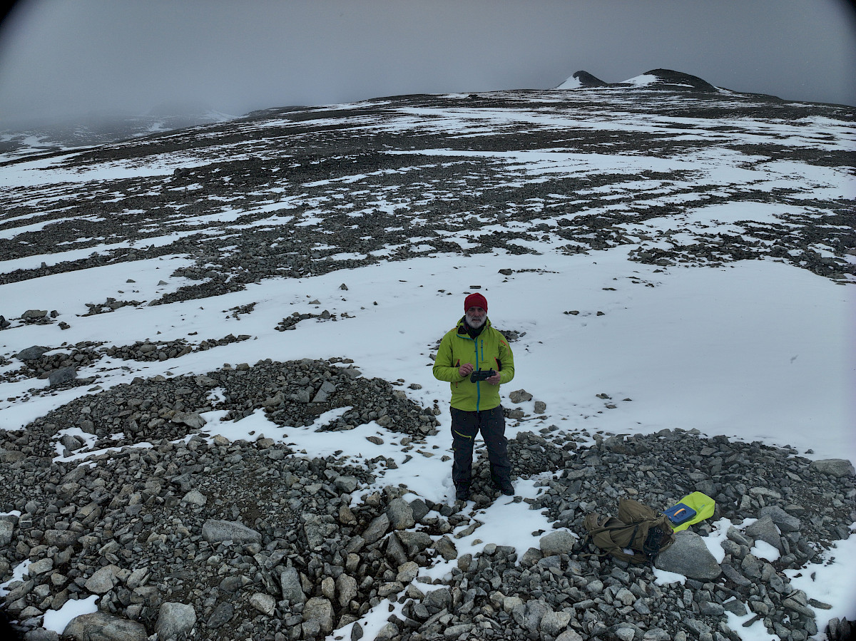
Pedro Pina, professor and researcher at the Department of Earth Sciences (DCT), Faculty of Sciences and Technology of the University of Coimbra (FCTUC), is studying and monitoring the evolution of sorted stone circles in Antarctica that have been forming for 10,000 years as the region's glaciers began to recede, creating ice-free zones.
All the geological information collected in the scope of the CAMOES project, funded by the Portuguese Polar Programme (PROPOLAR), will be compiled into a detailed map of this polar region.
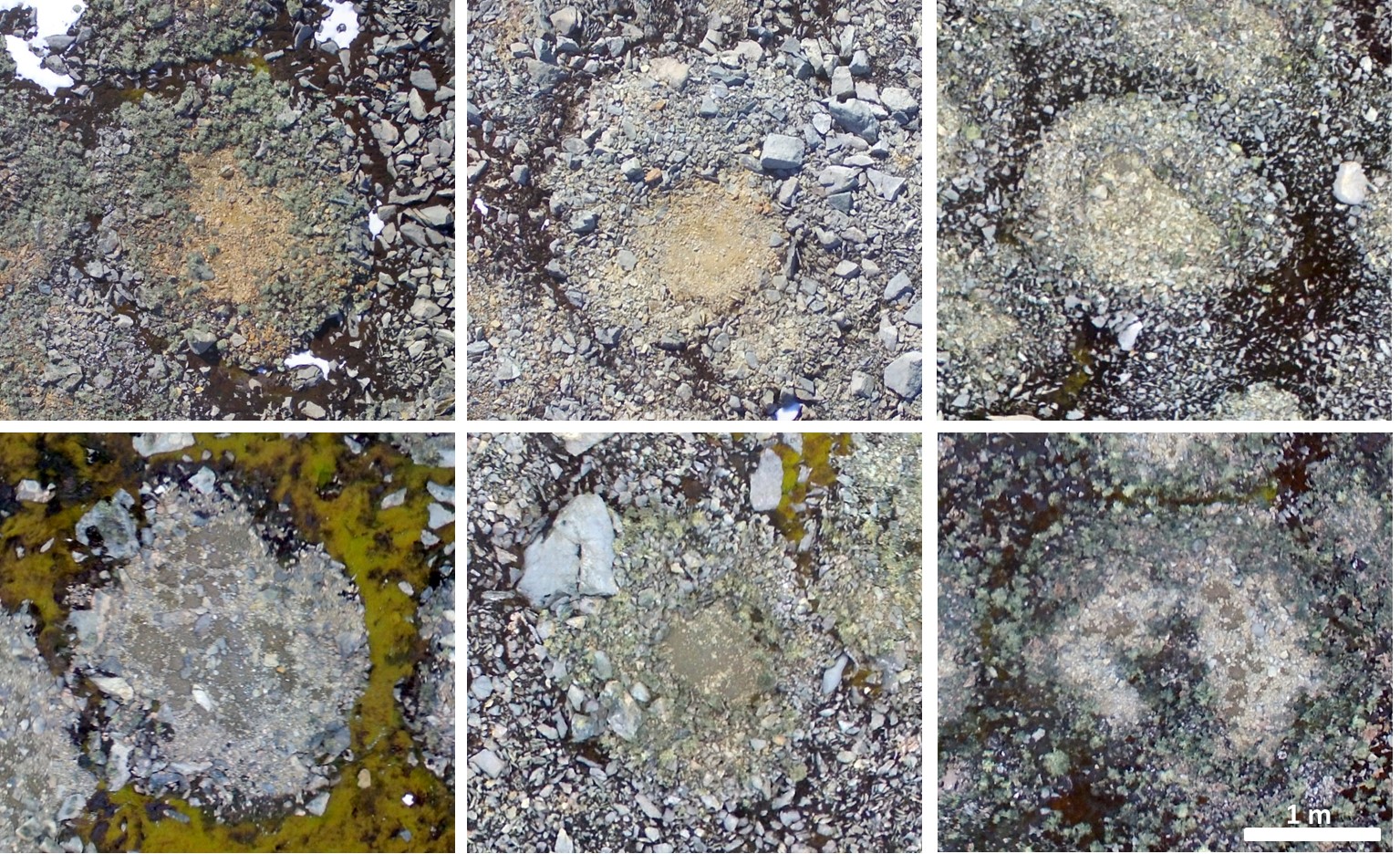
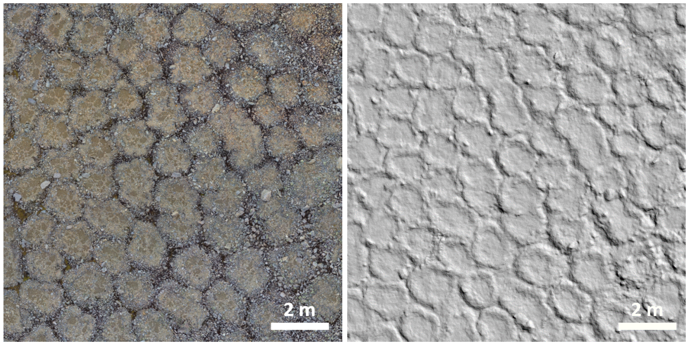
"In polar and high mountain areas, natural patterns of stone fragments often form, especially in ice-free areas such as permafrost, where the soil creates sorted circles of stone on the surface, 1-4 metres in diameter, due to seasonal temperature variations. We use satellite images and, more recently, ultra-high resolution images captured by UAVs (drones) to study and monitor the evolution of these circles," explains Pedro Pina.
Pina adds: "Permafrost is the permanently frozen layer of soil in the Earth's crust. However, when temperatures reach zero degrees or above, this layer begins to thaw, triggering a dynamic process similar to that of 'normal' soil. Eventually, this allows for the growth of ground vegetation, typically lichens and mosses, in Antarctica."
According to the DCT researcher, "These circles are formed by the seasonal dynamics of the soil. Even if it doesn't thaw, the soil is subject to temperature fluctuations throughout the year, causing it to move. This movement first pushes the larger stones from the subsoil to the surface and then 'arranges' them in a circular pattern on the surface. This natural phenomenon is a valuable indicator of the characteristics of past climates. It is fascinating to study these stone circles that have been forming for hundreds of thousands of years." he says.
"These patterns help us understand the climate in the region over the last 10,000 years. The monitoring aims to quantify the circles' spatial density, determining whether they are larger or smaller and still active. As their dynamics are always shallow (a few millimetres per year), we don't see them moving, but we can tell that they are active when the soil is damp. If it's covered with vegetation, it usually means they're not active," Pina explains, further adding that "The morphometric characterization of these circles, identifying the type of rock and soil and relating this information to the growth of vegetation, is also crucial for understanding the evolution of climate change.”
Click here for more information about PROPOLAR.
© DR
© DR